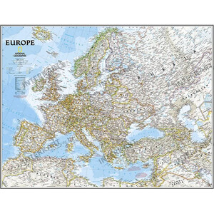
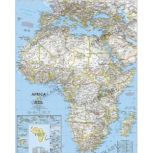
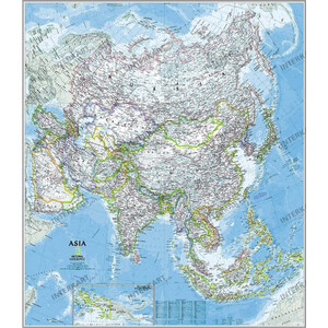
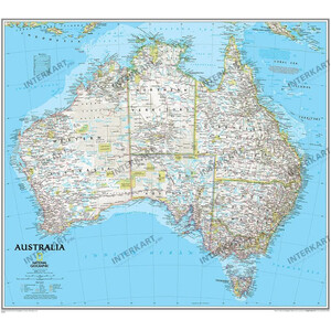
Please note that the map is in English!
The map uses the "Classic" cartography of the National Geographic Maps Division. This cartography is essentially political. Physical information is indicated by shading.
This map provides a complete and up-to-date overview of all countries in north america and south america.
It shows in detail:
- the states and countries
- the provinces, capitals and major cities
- the sea areas
- roads
- airports
- and many other geographical details.
An additional map section shows the physical geography of both continents, providing an excellent overview.
This map can be written on and wiped clean with water-soluble pens!
The map is delivered rolled up in a plastic tube.
The map is protected on both sides by a 0.07 mm thick, glossy polyester film.
Similar to illustration: The map will of course be delivered without the manufacturer's watermark!